el

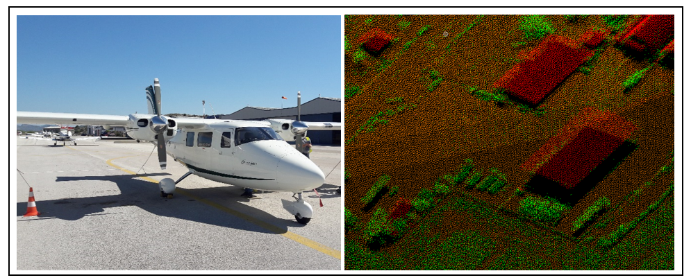
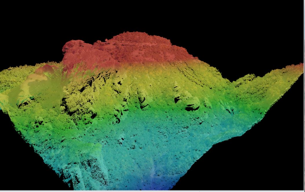
Aerial Coverage of the Area of the Sanctuary of Zeus at Mt. Lykaion through ALS/LIDAR and High Resolution Imagery

The geometric documentation of a cultural heritage site is demanding task due to the complex morphology of the objects. The last years, more and more researchers have used new laser technologies and sophisticated computer vision techniques, mainly for terrestrial applications, with a complementary use of land surveying measurements. Although such Read more…

aa

LiDAR and RGB airborne orthophotos coverage and visualization and recognition of archeological findings in Kephissos valley /Phokis

In 2016 the landscape archaeological program “Topographic investigations in the Kephissos valley (Phokis)” started as a joint collaboration of the DAI with the Ephorate of Antiquities of Fthiotida and Evrytania. The integrative collaborative program includes, besides archaeological investigations, aerial imagery (LiDAR, analysis of historical aerial photos), geophysical surveys and geomorphological Read more…

Skywatch home

SkyWatch

GEOSYSTEMS HELLAS S.A. has a good collaboration with SkyWatch in Greece and Cyprus providing various satellite data solution. We believe that providing a singular point to discover and access the world’s remote sensing datasets will bring amazing change to geospatial analytics. This mission isn’t about us. It’s about you. We Read more…

planet home

Planet

GEOSYSTEMS HELLAS is the PLANET legal reseller for Greece and Cyprus, providing high resolution satellite imagery  <= 80cm and also PlanetScope products. Planet provides geospatial insights at the speed of change, equipping users with the data necessary to make informed, timely decisions. Planet offers a diverse selection of imagery and Read more…

Skip to content