Latest News
Leica FCMS
Leica FCMS & Sensor Control Management System software performs a series of functions such as planning, guidance and flight monitoring for a large number of sensors. Read more..
Leica FCMS & Sensor Control Management System software performs a series of functions such as planning, guidance and flight monitoring for a large number of sensors. Read more..

Leica IPAS Freebird software contribute to flight economy and facilitate GNSS-IMU operations. Read more..
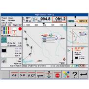
Leica FPES software offers advanced διαθέτει ανεπτυγμένη functionality for flight plans of RC30, ADS40, ADS80, και LIDAR ALS50, ALS60, ALS70 sensors but also for frame, line cameras or on/off sensors. Read more…
Leica MissionPro software offers «state of the art true 3D mission planning» solutions Read more..
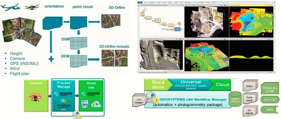
IMAGINE UAV is the ERDAS IMAGINE add-on module for the automated photogrammetric processing of UAV data, deriving high-quality geoinformation. The required products of an UAV survey such as point cloud, orthomosaic and digital elevation model are available in a short time and afterwards they can be directly evaluated. Output Formats: Read more…