HxGN Mass Transit is a platform that helps to manage your data, workflows and transit networks more efficiently. In HxGN Mass Transit you can combine asset and spatial data into an integrated network, avoiding data duplication. With its 3D and AI capabilities, HxGN Mass Transit has the ability to create an advanced digital twin of your city’s entire public transportation system.
CAPABILITIES
- Edit and access transportation network data
Individuals across the entire public transportation organization can create data, maps, reports, and queries for their projects, instead of having to rely on GIS specialists.
- Inspect and capture asset data in the field
Service workers have complete access, anywhere and anytime, to the data they need to fulfill specific tasks or projects with the mobile app. - Analyze, monitor and predict infrastructure status
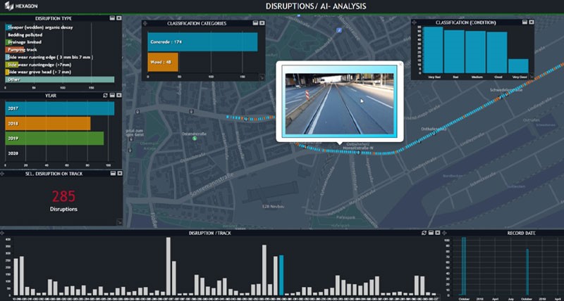
Spatio-temporal dashboards provide accurate information in 2D and 3D, including the results of artificial intelligence algorithms for feature extraction and predictive maintenance.
MODULES
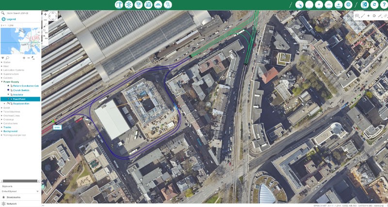
- Network – Build and maintain a digital network model of your transportation system.
- Track characteristics – Monitor the characteristics of your track network
- Station management – Station-related information such as accessibility, timetables, ticket machines and cleaning areas can be managed
- Electrification – Because public transportation networks are mostly operated by electric vehicles, it’s important to be aware of and maintain all electric infrastructure
- Construction / Building – Buildings and construction can be managed