ERDAS APOLLO
ERDAS APOLLO is a geographic information system for archiving, processing, searching and disseminating geospatial and non-geospatial data into any client and on any device, taking full advantage of their metadata. ERDAS APOLLO implements a Service Oriented Architecture (SOA) which provides the ability for customization and expansion to meet the geospatial or business process requirements of each organization.
Key Features:
- Integrated management of imagery and vector data and dissemination
- Organizing geospatial and operational data in a central library and distributing them via cloud
- Fast data sharing with less demanding hardware than competing products
- Fully interoperable: it incorporates OGC standards
- Full ECW support
- Utilization of existing systems: possibility of integration with other GIS environments
- Utilization of Spatial Models routines in the cloud – WPS
CAPABILITIES
- Fastest Image Delivery Possible
With the high-performance streaming imagery protocol ECWP, ERDAS APOLLO includes the fastest image delivery system on the market.
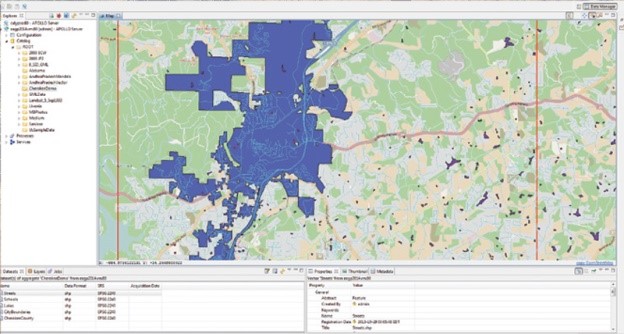
- Harvest, Catalog, Secure, and Publish All Data Types
ERDAS APOLLO comprehensively catalogs ALL of your data – including vector (GML, Shapefile, FGDB), point clouds, imagery, and ancillary business data – all in a single crawler.
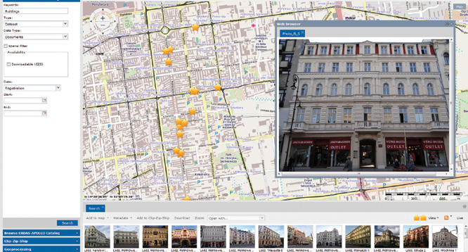
- A Host of Delivery Options
ERDAS APOLLO provides the greatest flexibility for geospatial data delivery, enabling dissemination into any client, on any device.
- Completely Interoperable
ERDAS APOLLO embraces OGC services as a primary, native implementation for accessing data. This ensures the greatest interoperability and flexibility when integrating ERDAS APOLLO into your current workflows.
- Flexible Deployment
Choose a deployment model that fits your needs and budget. Option to implement your ERDAS APOLLO solution: on-premises or on the cloud.
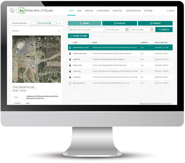
ERDAS APOLLO Studio (2022 Release)
ERDAS APOLLO Studio is a reimagined web client administrator for ERDAS APOLLO replacing the now legacy Data Manager desktop tool in the latest release of Power Portfolio 2022. Studio supports all major existing workflows with vastly improved user experience and more efficient configuration workflows. Delegate administration of your server or gain immediateaccess, all from within your web browser.
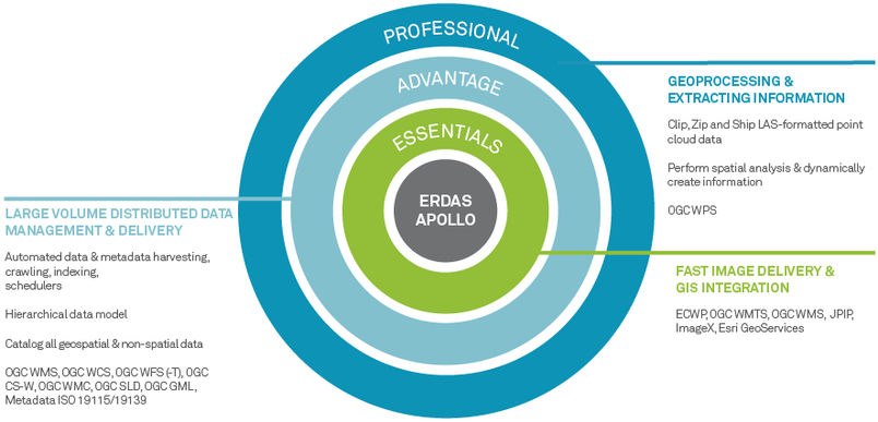
FLEXIBLE OFFERING
ERDAS APOLLO is available in three product tiers, suiting a wide spectrum of customer needs – from a low-cost, remarkably fast image server to a comprehensive data management system. All three tiers offer remarkably fast performance, even when handling massive data archives and thousands of concurrent users.
- ERDAS APOLLO Essentials
ERDAS APOLLO Essentials provides rapid sharing of geospatial imagery via a public access website. This unique product provides high-speed access to large volumes of imagery on a minimum hardware set. The solution can distribute massive amounts of data to thousands of users simultaneously, all from a single server. - ERDAS APOLLO Advantage
With ERDAS APOLLO Advantage, geospatial data that is distributed across multiple departments or offices can be easily organized and disseminated in a variety of ways, including web services, direct downloads, or Clip-Zip-Ship. This way, end users can ultimately search, discover, and visualize data in a variety of applications. - ERDAS APOLLO Professional
ERDAS APOLLO Professional provides server-side geoprocessing of geospatial data and offers a powerful geoprocessing (WPS) component, employing complex algorithms that accomplish unrivaled processing power. Using ERDAS IMAGINE or GeoMedia, geospatial analysts create custom models and publish them to the ERDAS APOLLO catalog. These spatial models can then be made accessible and executable on demand by users from a thin-client front end.
For more information please contact us
Contact person:
Stavros Chlorokostas
Surveying Engineer NTUA, Hexagon Geospatial Solutions Technical Support
![]() s.chlorokostas@geosystems-hellas.gr
s.chlorokostas@geosystems-hellas.gr
![]() +30 2102846144-145
+30 2102846144-145


