GEOMEDIA
GeoMedia®is a flexible and dynamic GIS package for creating, updating, managing and analysing valuable geospatial information from a variety of sources. It provides simultaneous access to geospatial data in almost any form and displays it in a single unified map view for efficient processing, analysis, presentation, and sharing. GeoMedia’s functionality makes it ideal for extracting information from an array of dynamically changing data to support informed, smarter decision-making.
SUPERIOR DATA ACCESS
- GeoMedia offers direct connection to the spatially- enabled databases they already use—such as Oracle, SQL Server, and PostGIS data server.
- GeoMedia can access many common geospatial file formats, most computer-aided design (CAD) formats (MicroStation and AutoCAD), Esri’s ArcView and File GeoDatabase, KML, simple text files, and OGC web services such as WMS, WMTS, and WFS.
- Ιncludes an ERDAS APOLLO catalog explorer to spatially search, find and display image data directly in the map window.
DATA VISUALIZATION AND QUALITY ASSURANCE
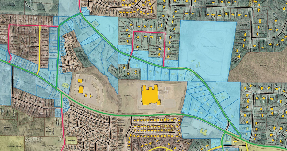
GeoMedia provides smart feature modelling capabilities that recognize the relationships between features representing real-world objects in a network, such as sewer, water, electric, or gas assets. By recognizing those relationships during the editing process, GeoMedia increases operator productivity and helps ensure that edits are consistent with real-world business rules so the network is always represented correctly within your GIS. It also provides temporal query and visualization capabilities that enable you to pinpoint network changes that have occurred over time and analyze the possible causes and real-world implications.
SOPHISTICATED, DYNAMIC ANALYSIS
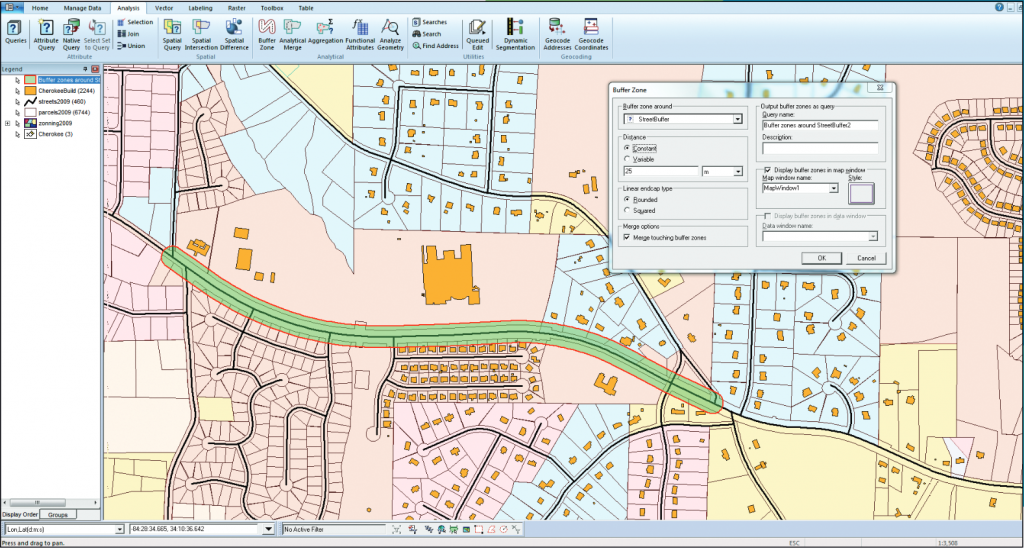
GeoMedia gives you the power to perform sophisticated analysis to extract information from data stored in multiple databases on different platforms and a variety of different files. It also enables you to create queries of unlimited intricacy, creating and concatenating queries together so that the results of one query feed into another query dynamically.
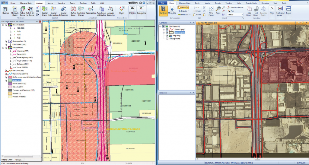
As the data changes, GeoMedia updates the results for you automatically, giving you a living picture of the real-life situations portrayed by your data. This capability can also be used to conduct powerful “what-if” analyses for strategic planning.
SPATIAL MODELER IN GEOMEDIA
Hexagon’s ERDAS IMAGINE has delivered Spatial Modeler for visually authoring simple-to-complex workflows using raster and feature operations, and Spatial Modeler is delivered with GeoMedia also. Many capabilities, some only available using GeoMedia or GeoMedia Image commands, can now be used with Spatial Modeler to process files, data, or other information that previously required programming or building GeoMedia custom commands.
CUSTOMISABLE
- Modify and customize aspects of the interface: easier to optimize specific workflows.
- Tailor the user interface to their particular needs and purposes.
- Hide parts of the interface, thus uncluttering the viewable work area and enabling faster recognition and access to work functions and tools.
FLEXIBLE OFFERING
GeoMedia is available in three product tiers. These tiers enable you to acquire the functionality you need and also allow to easily adjust the scope of the software to match your GIS management needs, analysis requirements, and budget.
GeoMedia Essentials
Enables you to query and analyse a wide variety of geospatial data sources. It also includes IMAGINE Essentials, giving you the ability to do simple image preparation.
GeoMedia Advantage
It has all the functionality of GeoMedia Essentials and is excellent for data collection and editing, processing and analyzing elevation and terrain data including LiDAR, and it includes data validation and sophisticated raster analysis tools. Four commands that were previously available only in the GeoMedia Professional tier are also now available in the GeoMedia Advantage tier: Insert Area by Face, Insert Interactive Area by Face, Dimensions, and Insert Dimensions.
GeoMedia Professional
It includes all of the features of the previous tiers and provides enterprise-wide, multi-user data management and analysis. Manage linear networks, produce professional cartographic maps, conduct advanced feature editing, manage parcel holdings, conduct utility network analysis, monitor and control changes, integrate data from multiple sources, design and use spatial models, and assure overall data quality with GeoMedia Professional.
Newest Release – GeoMedia Desktop 2022
Part of the new Power Portfolio 2022, GeoMedia 2022 comes with lots of fixes and enhancements:
- New Platforms supported
Oracle 19c, SQL Server 2019, G/Technology, PostGIS 3.1/PostgreSQL 13, CAD - General Additions
Drag-and-Drop improvements, New Online Support Command, New Commands for Layout Window and more - Data Access
Data servers for Oracle Object LTT and PostGIS, Connection to a PostGIS database and more - Map Display
Extended support for SVG symbols, Various map window additions
- Spatial Modeling
Improvements in present operators, Addition of various new operators
For more information please contact us
Contact person:
Christina Lydia Valdesera
Geographer HUA, Technical Sales Manager
![]() l.valdessera@geosystems-hellas.gr
l.valdessera@geosystems-hellas.gr
![]() +30 2102846144-145
+30 2102846144-145


