IMAGINE PHOTOGRAMMETRY
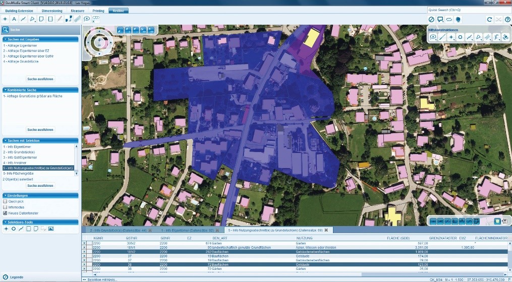
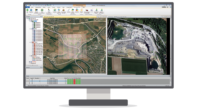
IMAGINE Photogrammetry is an integrated collection of software tools which enable the user transform raw imagery into reliable data layers required for all digital mapping, raster processing, GIS raster analysis, and 3D visualization needs. In addition, it uses state-of-the-art technologies for photogrammetry and image processing applications, perfecting data and controlling results. The functional design of IMAGINE Photogrammetry makes it possible to scale a variety of photogrammetric edits. Additional add-on functions and system personalization allow you to customize it to your needs.
Indicative applications and advantages:
- Triangulation: Tie imagery together and to ground reference points
- Orthorectification: Minimize the distortion inherent in imagery caused by sensor orientation, topographic relief displacement, and systematic errors
- Broad area mapping
- Transportation planning
- Engineering and facilities 3D mapping
- Defense applications
- Close-range applications
- Applications for 3D city/Smart city
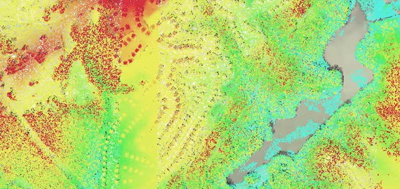
- IMAGINE Auto DTM has capabilities for fast, accurate automatic terrain extraction from multiple images
- Stereo Analyst® for ERDAS IMAGINE: collect, interpret, and visualize 3D geographic information from imagery
- ORIMA: provides sophisticated production photogrammetry software for block triangulation and analysis.
- IMAGINE Defense Productivity Module (Classified Usage Only): extends the already large suite of sensors and formats provided in IMAGINE Photogrammetry with support for NTM data in TFRD and NITF formats, including AMSD metadata and provides additional defense-oriented capabilities.
- Interoperable Photogrammetric Modules: PRO600 is a set of cartographic presentation tools to use within a Bentley® MicroStation® environment and Stereo Analyst® for ArcGIS® is tightly integrated with ArcGIS® which enables stereo collection inside your GIS environment to which you are already accustomed.
For more information please contact us
Contact person:
Katerina Fotiou
Surveying Engineer NTUA, Photogrammetry Expert, Key Account Manager
![]() c.fotiou@geosystems-hellas.gr
c.fotiou@geosystems-hellas.gr
![]() +30 2102846144-145
+30 2102846144-145