ERDAS Extensions for ArcGIS
“ERDAS Extensions for ArcGIS” are simple, affordable products to generate feature layers based on imagery, unlocking the power of remote sensing and stereo photogrammetry inside your ArcGIS environment.
Features:
- Bring Stereo into Your ArcGIS Experience
Stereo Analyst® for ArcGIS lets you distinguish 3D features in your imagery faster and more easily, and increases the accuracy of the features that you collect. - Edit Terrain Directly Inside of Your GIS
ERDAS Terrain Editor for ArcGIS allows you to edit your terrain files using the stereo viewing environment, while updating your Geodatabase Terrain datasets. - Collect Your Rooftops With Ease
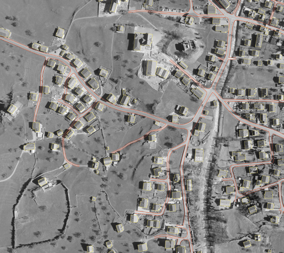
Using the canned templates in the Feature Assist for ArcGIS tool, you can collect any complex rooftop in seconds. Bring Stereo into Your ArcGIS Experience - Semi-Global Matching (SGM)
3D Point Clouds Extracted from Photogrammetric Data with Semi-Global Matching. - Photogrammetry Overview
Transform large quantities of raw spatial data to an exploitable format.
See More…
For more information please contact us
Contact Person:
Stavros Chlorokostas
Surveying Engineer NTUA, Hexagon Geospatial Solutions Technical Support
![]() s.chlorokostas@geosystems-hellas.gr
s.chlorokostas@geosystems-hellas.gr
![]() +30 2102846144-145
+30 2102846144-145