Skip to content
  • The Company
    • Profile
    • Our Team
    • Associates
    • Publications
  • Products
    • Hexagon Geospatial software
      • Remote Sensing
        • ERDAS IMAGINE
        • Atcor
        • IMAGINE NoClouds
        • Sentinel Made Simple
      • Photogrammetry
        • IMAGINE PHOTOGRAMMETRY
        • IMAGE STATION
        • IMAGINE UAV
      • GIS and Mapping
        • GEOMEDIA
        • GEOMEDIA SMART CLIENT
      • Web GIS
        • GEOMEDIA WebMap
        • GEOSPATIAL Portal
        • GEOSPATIAL SDI
      • Data Management
        • ERDAS APOLLO
        • ECW Compression
        • GeoCompressor
      • Technical Support
    • Leica Geosystems sensors
      • Sensors
        • Leica RCD30
        • Leica RCD30 for UAV
        • Leica RCD30 Oblique
        • Leica RC30
        • Leica ADS80 Airborne Digital Sensor
        • Leica ALS70 Airborne Laser Scanner
      • Lidar Sensors
        • Leica RCD105 Digital Frame Camera
        • Leica ALS70 Airborne Laser Scanner
        • Leica ALS60 Airborne Laser Scanner
        • Leica ALS Corridor Mapper
      • Leica Software
        • Leica ORIMA
        • Leica XPro
        • Leica FCMS
        • Leica IPAS Freebird
        • Leica FPES
        • Leica MissionPro
    • Satellite Imagery
      • Optical data
        • Planet
        • Skywatch
      • SAR data
        • COSMO-SkyMed
    • Smart M.Apps
  • Projects-Services
  • Trainings-Conferences
  • R&D
    • Completed R&D projects
    • Ongoing R&D projects
  • Contact
  • English
    • Ελληνικά
    • English
Geosystems Hellas S.A.
FacebookTwitterLinkedin
 
  • The Company
    • Profile
    • Our Team
    • Associates
    • Publications
  • Products
    • Hexagon Geospatial software
      • Remote Sensing
        • ERDAS IMAGINE
        • Atcor
        • IMAGINE NoClouds
        • Sentinel Made Simple
      • Photogrammetry
        • IMAGINE PHOTOGRAMMETRY
        • IMAGE STATION
        • IMAGINE UAV
      • GIS and Mapping
        • GEOMEDIA
        • GEOMEDIA SMART CLIENT
      • Web GIS
        • GEOMEDIA WebMap
        • GEOSPATIAL Portal
        • GEOSPATIAL SDI
      • Data Management
        • ERDAS APOLLO
        • ECW Compression
        • GeoCompressor
      • Technical Support
    • Leica Geosystems sensors
      • Sensors
        • Leica RCD30
        • Leica RCD30 for UAV
        • Leica RCD30 Oblique
        • Leica RC30
        • Leica ADS80 Airborne Digital Sensor
        • Leica ALS70 Airborne Laser Scanner
      • Lidar Sensors
        • Leica RCD105 Digital Frame Camera
        • Leica ALS70 Airborne Laser Scanner
        • Leica ALS60 Airborne Laser Scanner
        • Leica ALS Corridor Mapper
      • Leica Software
        • Leica ORIMA
        • Leica XPro
        • Leica FCMS
        • Leica IPAS Freebird
        • Leica FPES
        • Leica MissionPro
    • Satellite Imagery
      • Optical data
        • Planet
        • Skywatch
      • SAR data
        • COSMO-SkyMed
    • Smart M.Apps
  • Projects-Services
  • Trainings-Conferences
  • R&D
    • Completed R&D projects
    • Ongoing R&D projects
  • Contact
  • English
    • Ελληνικά
    • English
Leica IPAS Freebird
Home Latest News Leica IPAS Freebird
Leica IPAS Freebird

Leica IPAS Freebird

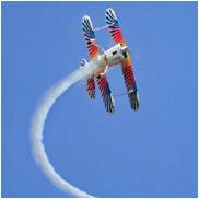
Leica IPAS Freebird software contribute to flight economy and facilitate GNSS-IMU operations.

Read more..

Leica FPES
Leica FCMS

Recent Posts

  • Next-Generation PlanetScope Imagery
  • GSH is involved in the ESA-funded project : Synergetic use of Blockchain and Deep Learning for Space Data – BLENDED
  • GSH attends Geomedia 2020 Advanced Training
  • GSH attends M.appX 2020 Training
  • Copernicus Hackathon in Athens 2020
March 2021
M T W T F S S
« Jun    
1234567
891011121314
15161718192021
22232425262728
293031  

Follow us

  • Facebook
  • Twitter
  • Linkedin

Categories