GEOSPATIAL Portal

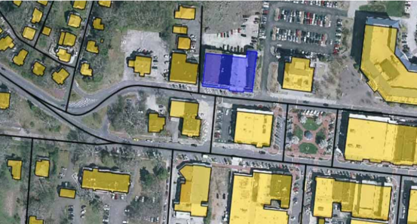
Geospatial Portal is a browser-based, multilingual web application that can be used for finding, viewing, querying, analyzing and consuming geospatial data and web services published by other Hexagon Geospatial solutions or third-party products. It offers advanced client-side discovery, connection, and interaction through a simple client geo-browser that provides an intuitive Read more…

IMAGINE UAV

IMAGINE UAV is the ERDAS IMAGINE add-on module for the automated photogrammetric processing of UAV data, deriving high-quality geoinformation. The required products of an UAV survey such as point cloud, orthomosaic and digital elevation model are available in a short time and afterwards they can be directly evaluated. Output Formats: Read more…

σδ

IMAGINE PHOTOGRAMMETRY

IMAGINE Photogrammetry is an integrated collection of software tools which enable the user transform raw imagery into reliable data layers required for all digital mapping, raster processing, GIS raster analysis, and 3D visualization needs. In addition, it uses state-of-the-art technologies for photogrammetry and image processing applications, perfecting data and controlling Read more…

wm

GEOMEDIA WebMap

Geomedia WebMap enables direct creation of interactive web maps by using the configuration and application creation tools provided in GeoMedia itself, eliminating the need for programming. Configure the layout of the web application interface and create user-defined queries and other components. Provide direct, real-time access to your geospatial data. Users Read more…

GEOSPATIAL SDI

Geospatial SDI is an interoperable and scalable spatial data infrastructure designed for data providers that need to manage and serve secure or licensed information using standards-based web services. It offers powerful tools for controlled access to standards-compliant services and data published by those services, as well as tools for monitoring Read more…

Skip to content