DMC3/TripleSat Constellation
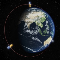
The DMC3 / TripleSat Constellation is a new satellite formation launched in July 2015 and provides data distributed by Earth-i.
It consists of 3 optical, multi-spectral satellites of high resolution, of low altitude.
Advantages
- Very high resolution (1m)
- Quick retrieval and data availability
- 4 multi-spectral and panchromatic bands
- Extremely accurate georeference
- Estimated satellite lifespan – 10 years
- Maximization of visualization capabilities through Coordinated orbit
- Completion of 45 orbits per day
Applications in the Fields:
- Energy and Natural Resources
- Urban planning, spatial planning
- Navigation tracking, monitoring and tracking
- Cartography
- Agriculture
- Environment – Disaster Management
- Commercial
| Satellite and Track Features | |
| Satellite Orbit | Sun-synchronous, altitude of 651 km |
| LTAN | 1030 hrs |
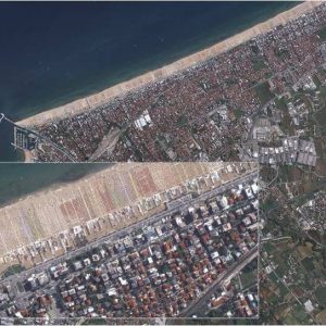
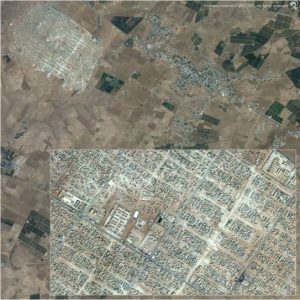
| Optical Sensor GSD | Panchromatic: 1 m (nadir) Multispectral (R, G, B, NIR): 4 m (nadir) |
| Swath | 23 km |
| MTF at Nyquist | Panchromatic: 10% Multispectral: 20% |
| Off-nadir capability | +/- 45 degrees |
| Stereo slew capability | +/- 30 degrees |
| SNR | All bands > 100:1 |
| Safety & Security | 128bit AES encryption of all command,telemetry and payload data |
| Dissemination of data at 1m resolution for panchromatic channel, 4m resolution for true colour and near infrared channels. These data can be compiled into a 1m resolution image. Multiple scenes capabilities (stereo και large area) Ability to automatically order georeferenced products Angle of reception up to 45 degrees Capability of repeated captures to achieve a small percentage of cloud cover. Image Format: GeoTIFF or JPEG 24km image width in stripmap mode, 46km in area mode |
|