Latest News
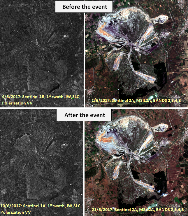
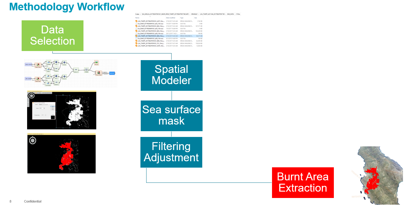
Rapid and operational estimation of post-fire burned areas using Sentinel 2 data: The case studies of Kythira and Saronida
Accurate estimation of post-fires burned area, has always constituted a significant objective for national and international environmental organizations. Nowadays, climate change and the continuous deforestation (particularly in southern Europe) require a fast but robust methodology that acquires data, process and ultimately enables governmental institutions to proceed with environmental policies such Read more…