Airborne LIDAR remote sensing techniques for monitor 3D industrial cities
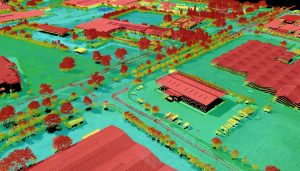
Airborne LIDAR (Light Detection and Ranging), is an active remote sensing method that uses light in the form of a pulsed laser to measure ranges (variable distances) to the Earth. These light pulses, combined with other data recorded by the airborne system, generate reliable and precise three-dimensional (3D) information, in terms of point cloud, about the shape of the Earth and its surface characteristics. A LIDAR instrument principally consists of a laser, a scanner, and a specialized GPS receiver. Airplanes are the most commonly used platforms for acquiring LIDAR topographic data over broad areas. An airborne LIDAR mission process is called Airborne Laser Scanning (ALS).
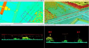
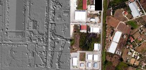
Compared to traditional photogrammetry, GPS and land surveying, LIDAR provide: 1) higher and homogenous accuracy, 2) fast acquisition of massive data (point clouds) and processing, 3) minimum human dependence, 4) weather/light independence, 5) canopy and vegetation penetration through LIDAR pulses, 6) higher data density (very dense point clouds), 7) Ground Control Points (GCPs) independence, i.e., few GCPs are needed for the georeference process and for the qualitative and quantitative control (this makes LIDAR ideal for mapping inaccessible and featureless areas), 8) additional information such intensity, multiple returns, etc., and 9) cost-effectiveness for big covered areas, e.g., for national/public work studies or services. However, several research approaches have been proposed the recent years that fuse LIDAR and aerial imagery to exploit both: the good geometric quality of ALS and the spectral image information for object detection and feature extraction, forest canopy modeling, 3D mapping and reconstruction, 3D city modeling in terms of Level of Details (LoDs), smart cities, BIMs, etc. Despite the constant technological development of computer vision, computer graphics and aerial/space technology, the accurate, reliable and rapid 3D reconstruction of complex scenes such the industrial ones still remains challenging.
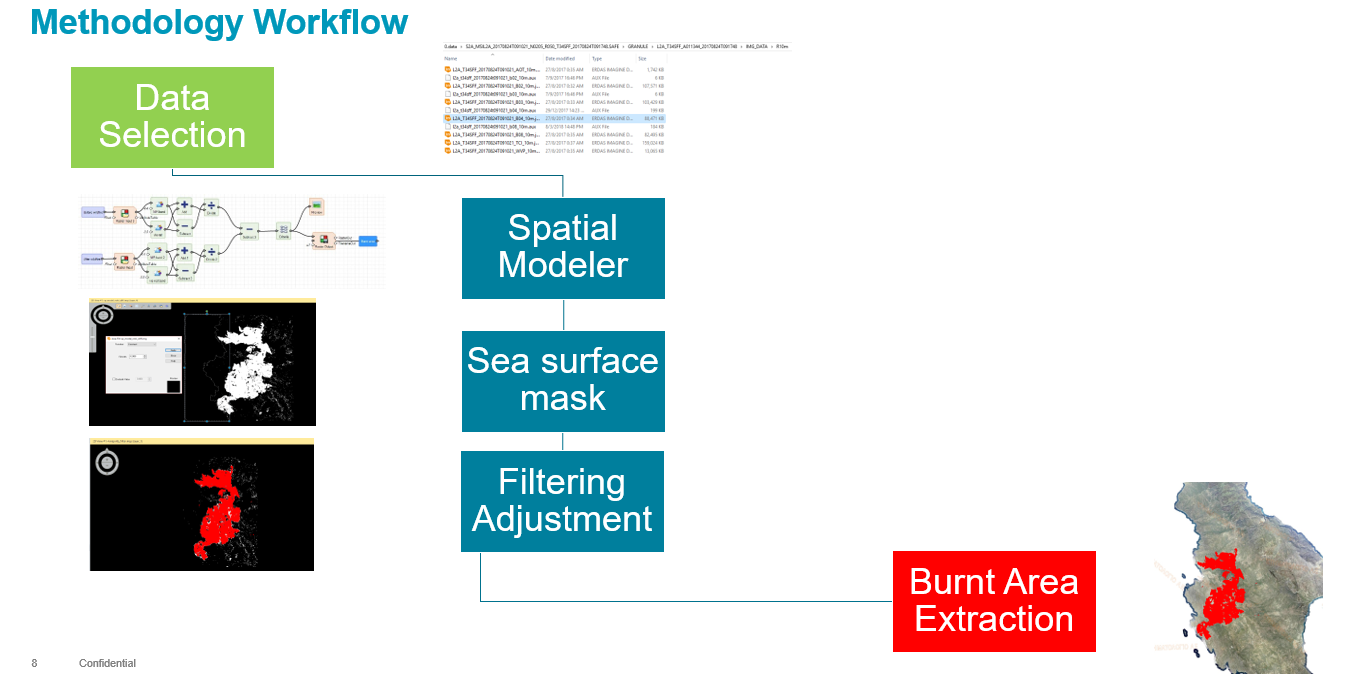
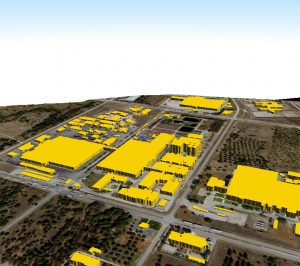
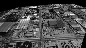
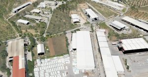
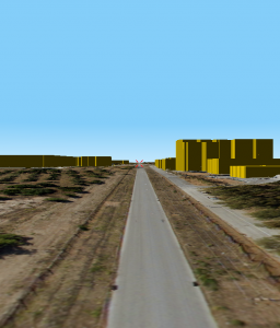
In this study a multi-modal data fusion approach is implemented, that is LIDAR and aerial RGB imagery, to create 3D modern cartographic backgrounds for smart and safe management of industrial areas. A complex industrial area of 4.3 km2 at Greece was used as case study.
Further reading:
- Maltezos, E., Charalampopoulou, B. 2018. European Association of Remote Sensing Companies (EARSC) (http://eomag.eu/articles/4270/airborne-lidar-remote-sensing-techniques-for-monitor-3d-industrial-cities)
Precision sensing with Lidar technologies is a powerful technology that provides many benefits, including high accuracy, cost savings, real-time monitoring and analysis, and easy integration with the existing infrastructure of an on-site system.
Such large-scale footprinting applications can be used in cities, settlements and critical infrastructures and make them ‘smarter’. In today’s challenges like climate change, extreme weather, traffic congestion, pollution, etc., large-scale three-dimensional (3D) imaging can be extremely useful. The city’s Digital Twin is involved at every level of management, from transportation, emergency or public utility services, or urban planning. It gathers multi-level data sources, such as: buildings, urban infrastructures, IoT data, utilities, businesses, people and vehicle movements, civil protection simulations, etc.
GEOSYSTEMS HELLAS A.E. offers a combination of expertise and knowledge with innovative technologies and forward-looking developments to modernize cities and regions.