Rapid and operational estimation of post-fire burned areas using Sentinel 2 data: The case studies of Kythira and Saronida
Accurate estimation of post-fires burned area, has always constituted a significant objective for national and international environmental organizations. Nowadays, climate change and the continuous deforestation (particularly in southern Europe) require a fast but robust methodology that acquires data, process and ultimately enables governmental institutions to proceed with environmental policies such as forest rehabilitations or agricultural compensations. Sentinel data from ESA’s Copernicus program can play a key role to this methodology, by providing multi-temporal satellite data of high quality and thus capture an area of interest right before and just after a wildfire event. Towards this direction, the aim of the present work is to examine and specify the total burned area of two different wildfire events that occurred in summer 2017 in Kythira and Saronida, Greece, by exploiting the Spatial Modeler feature of Erdas Imagine software. For each case study, three simple yet efficient approaches were implemented: i) Near Infared-band subtraction, ii) NDVI index and iii) NBR index.
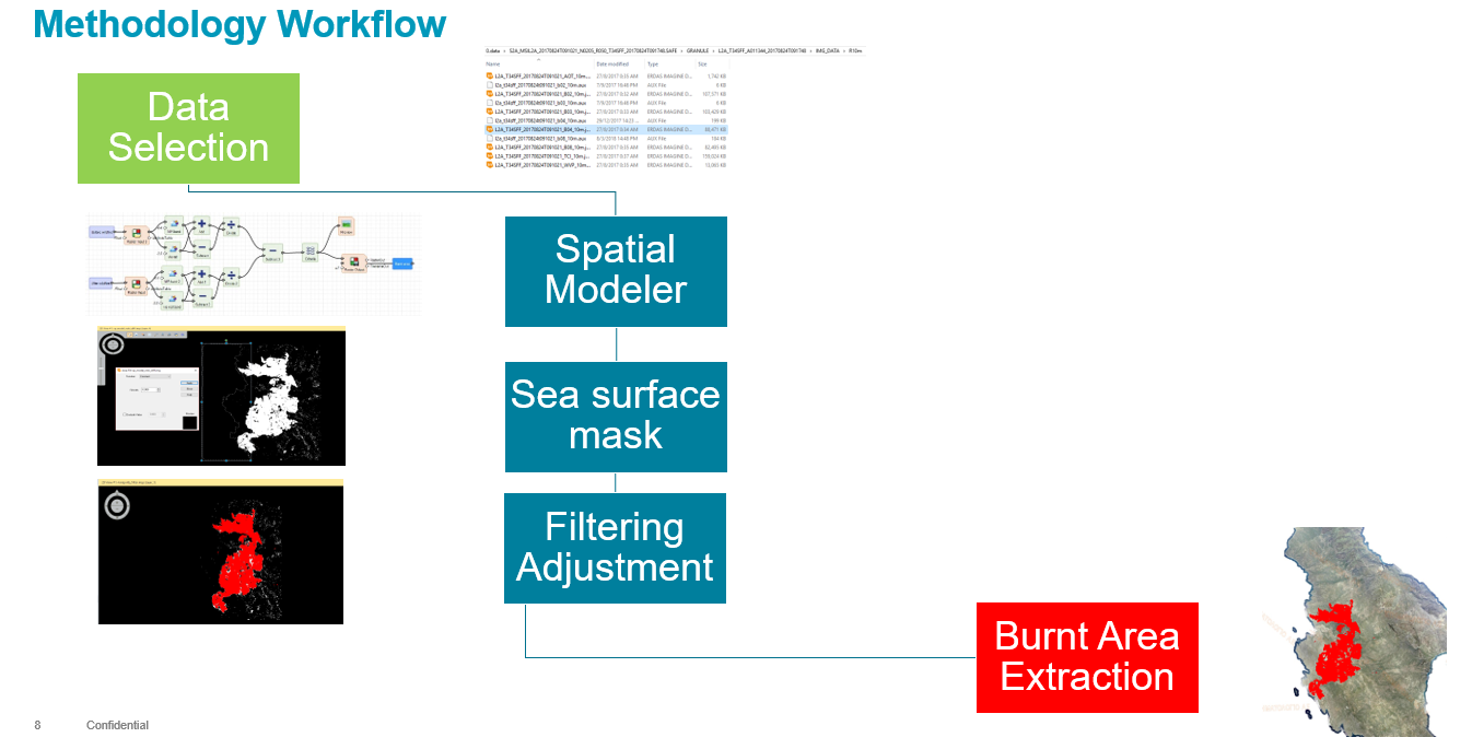
The extracted results for all cases, indicate that the synergy of a powerful and highly customizable tool as Erdas Imagine’ Spatial Modeler with Sentinel 2 data can instantly deliver reliable and highly accurate estimation of burned areas. Furthermore, the proposed approach can be easily implemented through a web-GIS platform allowing precise and timely decision making by authorities.


